

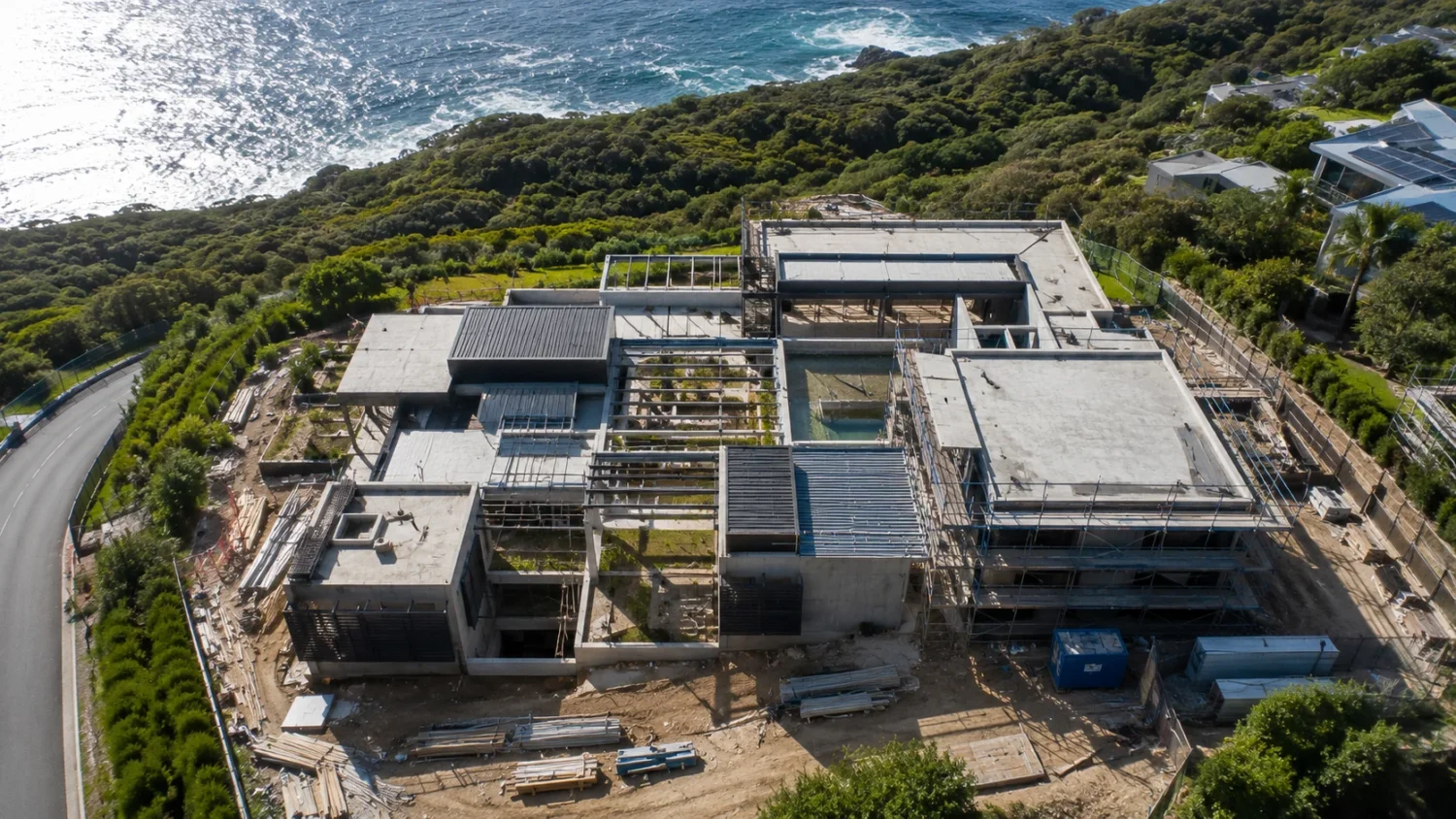

Aerial capture on a construction site is often framed as a surveying convenience: a faster way to get a photo of the whole property. That framing understates what has actually changed. Once a project moves from design into active earthwork and grading, the value of aerial data shifts from a nice overview to a specific, measurable substitute for tasks that used to require a person walking a hazardous site with a rod and a notebook.
That shift is now large enough to show up in national aviation and labor statistics, not just individual project case studies.
The Scale of Adoption Is No Longer A Pilot Program
Commercial drone use has moved well past the early-adopter phase. By the end of 2024, more than 124,000 new commercial operators registered their equipment with the Federal Aviation Administration in a single year, and the cumulative commercial fleet reached roughly 966,000 registered aircraft, a number the FAA had actually underestimated in its own prior-year forecast. The agency projects the commercial fleet will exceed one million units within the next few years, with real estate and construction consistently ranking among the most common declared uses for Part 107 certified operators.
That growth has coincided with a change in what pilots are actually doing with the aircraft. Non-recreational Part 107 operators report a median of far more flights per year than recreational-only operators, and the FAA’s own annual survey shows commercial, business, or hire-based operation as the single largest self-identified use case among non-recreational registrants. In short, the aircraft that were experimental five years ago are now a standing category of professional equipment with predictable growth trends the FAA can forecast years out.
What Aerial Capture Replaces, Specifically
The most concrete evidence of aerial capture’s value on active construction sites comes not from vendor case studies but from a federal transportation research brief examining how state departments of transportation use the technology for construction quantity estimation. Before this generation of tools, surveying as-built conditions on infrastructure projects relied on robotic total stations and manual tachymetry, methods that are labor-intensive, slow, and vulnerable to human error at scale.
Small unmanned aircraft systems paired with structure-from-motion photogrammetry now produce measurable, comparable alternatives. Multiple studies evaluating the impact of resulting elevation models on earthwork calculations found the variance in volume measurement to be within 1 to 2 percent, a tolerance considered acceptable for construction quantity work. Separately, a comparison of drone-derived stockpile measurements against terrestrial laser scanning found an average vertical difference of just 2 millimeters. These are not marketing claims; they are findings from research conducted for the purpose of establishing whether the method is fit for the specific job of paying contractors accurately for work performed.
That distinction, being fit for a specific measurement task rather than simply “helpful,” is what separates aerial capture from a general documentation habit. Owners and contractors evaluating drone mapping as part of a site documentation workflow are, in practice, asking whether the resulting data can substitute for a survey crew on a specific task, not just supplement a status report.
The federal research brief is also specific about what makes that substitution reliable, which is worth understanding before assuming any aerial data is automatically survey-grade. Accuracy depends heavily on the placement of ground control points, image-identifiable markers whose coordinates are established using accurate GNSS equipment on the ground before or during the flight. Establishing five or more of these points, distributed evenly across the site rather than clustered at the edges, is the practice associated with the accuracy figures cited above. Without them, the resulting 3D model can still be usable for general visual reference, but it loses the precision needed for quantity verification and payment decisions. This is a meaningful distinction for anyone comparing a casual drone photo service against a workflow built specifically around measurable output.
Why Site Access Is A Real Cost, Not Just An Inconvenience
There is a less obvious reason aerial capture has proven valuable, and it has less to do with data quality than with where people have to stand to collect it. Falls to a lower level remain one of the most common fatal events in the construction and extraction occupations. In 2024, falls, slips, and trips accounted for 844 fatal work injuries nationally, and construction and extraction workers alone experienced 1,032 total fatalities that year. More than one in ten fatal falls that year involved a worker falling from a height over 30 feet, precisely the kind of exposure that traditional site surveying, inspection, and stockpile measurement can require.
Every task that a small aircraft can perform from the air instead of requiring a person to physically access an elevated, unstable, or otherwise hazardous position is a task removed from that exposure entirely. This is not a marginal benefit layered on top of the measurement case; it is a separate and independently justifiable reason the technology has scaled as quickly as it has among state transportation agencies and large contractors, where crews are frequently working around active excavation, structural framing, and elevated formwork.
Federal research on drone-based earthwork measurement found volume variance within 1 to 2 percent when compared against traditional survey methods, and a separate comparison against terrestrial laser scanning found an average vertical measurement difference of just 2 millimeters, figures that meet the accuracy threshold required for construction payment verification.
What This Means For How Sites Actually Operate
None of this suggests aerial capture eliminates the need for ground-based survey work, quality inspection, or physical verification. Ground control points, established using accurate GNSS units, remain necessary to achieve the accuracy levels described above, and a knowledgeable person still has to decide what to fly, when, and how to interpret the resulting model. The technology extends what a smaller team can verify without eliminating the judgment involved.
What has changed is the default assumption about which tasks require physical site access. A few practical patterns follow from the current state of adoption and research:
– Earthwork and stockpile verification are now measurement tasks, not just visual checks. With appropriately placed ground control points, the resulting volume calculations meet the accuracy bar needed for progress payments and change order verification, not just general awareness of where dirt has moved.
– Pre-construction topography verification reduces disputes before they start. Comparing existing-condition point clouds against design assumptions before earthwork begins catches discrepancies while they are cheap to resolve, rather than after a bid has been submitted based on inaccurate assumptions about existing grade.
– Site access should be evaluated as a safety decision, not only a data decision. Any inspection or measurement task that would otherwise require a person to work at height, near an excavation edge, or around active heavy equipment is a candidate for aerial capture on safety grounds alone, independent of whether it is also faster.
– Documentation cadence matters more than any single flight. Because the underlying registered commercial fleet and pilot population continue to grow, regular capture, not a one-time survey, is what produces a comparable record over time as a project moves from mobilization to substantial completion.
Aerial capture on a construction site amounts to more than a faster camera. It functions as a measurement method that has been independently tested against the standards contractors and owners already use to verify earthwork and quantities, and it removes a specific, well-documented category of physical risk from the people who would otherwise have to collect that same information on foot. Those two facts, not the novelty of the aircraft itself, are why adoption has continued to climb rather than plateau after the initial wave of interest.
You Might Also Like


